Hiking Frenchman Mountain – Las Vegas, NV
This was actually a hike that we took in mid May – back when the temperatures were not in the triple digits as they are now 🥵. Even for mid May, it was a little too warm if you were to get a late start. We arrived at the trail head at around 10 in the morning, and by the end of the hike, it was pretty hot out. If we ever hike it again (or do ANY hike in this area, for that matter), early Spring and Fall are probably the best time of year to hit the trails here. That said, this was a fantastic hike!
Frenchman Mountain is situated just east of Las Vegas on the way out to Lake Mead Recreation Area. It supposedly got the name “Frenchman Mountain” from the Frenchman Mine. This was a scam (that is the rumor at least) by a Belgian immigrant that was, at the time, thought to be French.
Paule Watelet came to the area around 1905. He was a Belgian miner that had become a manager of the South Nevada Mining Company. He claimed that he had found gold on the mountain, and in 1912, produced two chunks of rock that appeared to have gold particles in them. When word got out that Frenchman Mountain was a hotspot for a gold mine, prospectors began to show up from all over, looking to get rich. (Some things never change – people still show up to Las Vegas from all over thinking they are going to get rich 🙂 )! For the next two years, “mining” went on as the company claimed it would be building new towns. However, after those two years, Watelet and the other men involved, abruptly left town. Mining came to a hault. No one ever saw any gold come out of Frenchman Mountain, and in 1960, they sent teams in to search the mines. There was absolutely no evidence that anything was ever truly mined there. To this day, it remains a mystery what was actually taking place within the mines on Frenchman Mountain.
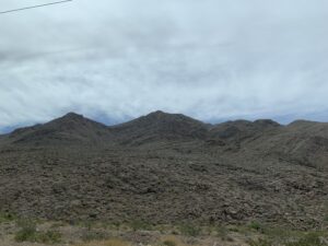
The rocks that make up Frenchman Mountain, are the same type of rock found at the bottom of the Grand Canyon, and are some of the oldest rock on the North American continent. Frenchman Mountain is also the site for some of the more prominent fault lines that run through Las Vegas – including Frenchman Fault. It is this zone of faults that are responsible for the mountain range of Frenchman Mountain. Because of this, the buildings that make up the Las Vegas Strip, are built to withstand the force of a high magnitude earthquake, should one hit. Thanks, but I will pass on testing that theory. 😳
So, now that I told a little bit about the history of the mountain, I will talk about our actual hike 🙂
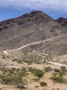
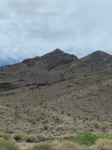
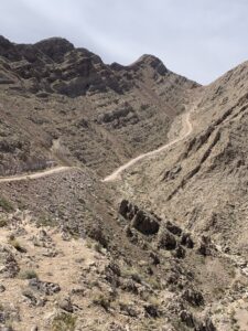
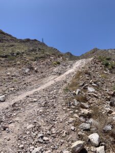
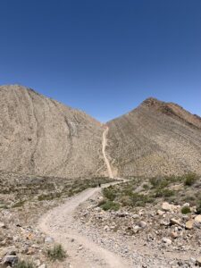
As you drive by the trail head on the main road, it looks very deceiving. From the road, the trail looks very smooth, slightly steep, and pretty short. according to my trail app, it is rated as moderate to hard, and is dog friendly.
I honestly thought this would be a quick hike – maybe an hour or so – and that it did not look like it would be that difficult. I also did not expect that there would be a lot to see. I thought I was looking at the majority of the trail when I was looking at it from the road.
Something was telling me though, to pack plenty of water and protein bars, and have the doggos sit this one out.
I am glad I listened to whatever that feeling was.
I was not only wrong about what I thought that hike would be like….I was VERY wrong.
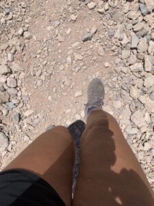
We parked the truck, put our packs on, and started out.
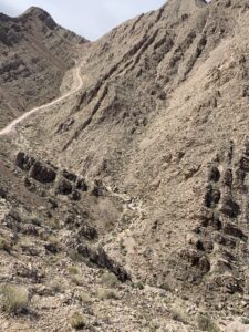
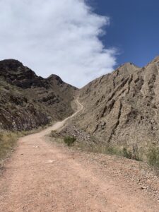
The section of trail that is seen from the road, is just a very tiny section of this hike….and probably the easiest section.
There weren’t too many people hiking up it that morning (we had driven past there a few times, and the trail just looked packed), but we were also not the only ones. We passed a couple that were on their way down (we were just getting started), and I asked them if they had made it to the summit. They replied that they had made it – to BOTH summits! Huh?! I did not know anything about this second summit. (Honest, I do research our hikes beforehand, and nowhere did I see that there were two summits!). I asked them how long they had been hiking, and they said that it had taken them about 5 1/2 hours! This was not going to be the quick little “maybe an hour hike” that I thought it would be. I was going to the summit! Both of them!
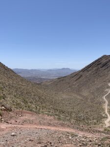
The first little stretch of hike was fairly steep, and leveled out at a really nice overview.
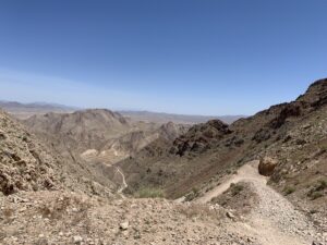
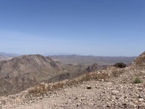
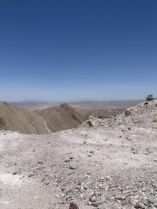
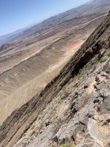
From here, you could see the valley below (there were actually a couple of really old cars down there, which I hope were not there because they drove over the cliff).
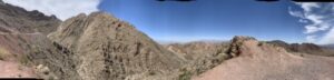
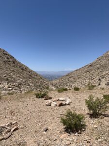
You could see (part) of the trail ahead, it looked like it wouldn’t be to bad. You could see Sunrise Mountain from here – a lot of people actually confuse Frenchman Mountain with Sunrise Mountain…the sun rises over both), and you could see the road. The road already looked so far away.
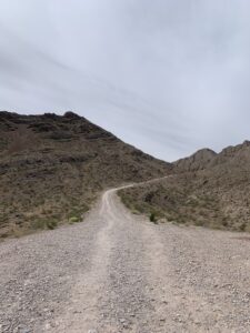
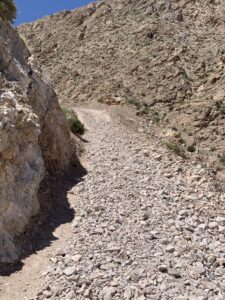
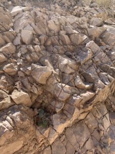
We continued up the trail, which was actually steeper than it looked at this point. The trail is nice and clear, but it is rock the whole way. There are times that it is hard to get good footing, so there is considerable slipping and sliding at times.
Without fail – I think I say this every hike – I always find out how not-in-shape I am when I hike like this. We reached a point in our hike, where we literally would hike about 50 yards, stop, take a breather, and continue on.
Just before reaching our first group of switchbacks, we passed another hiker on his way down.
He was moving slowly, and stopped to tell us we were just about to the first set of switchbacks. After that, it wouldn’t be long before we would reach the first summit. He said he turned around there, but if we chose to go on, it would just be a “quick descent down and then back up” to the second summit. He made it sound like we would be on our way back in no time. Easy day. We were already feeling the heat from the sun, and the steepness mixed with the loose rocks made for some tricky spots. I began to think that maybe that first couple just stayed at the summits for awhile and that is why it took them over 5 hours. No. I was wrong again. I am not even sure if that man who told us the summit was just ahead, really even went there. I am having my doubts.
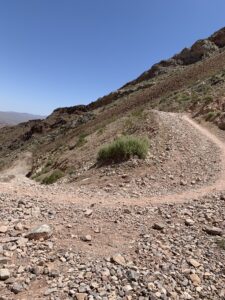
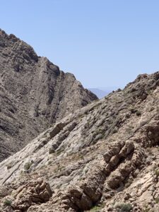
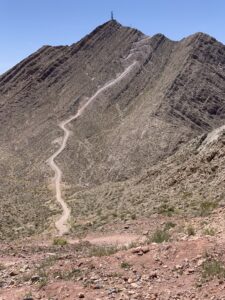
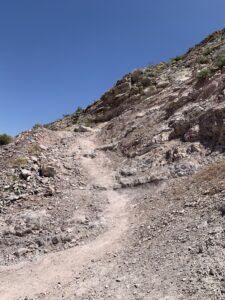
We hit that first set of switchbacks. There were a lot. As they winded there way back and forth across the mountain, each turn in them opened up a new sight. It was exciting to get different views from each turn.
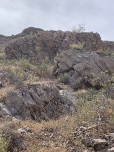
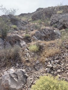
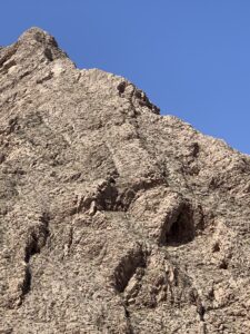
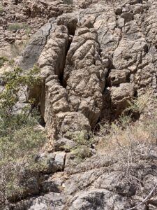
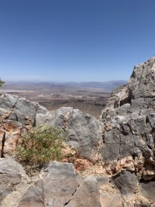
The rock formations as we hiked along, were really fun to look at.
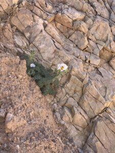
It always amazes me how plant life , that high up, just randomly grows out of the rock.
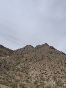
Eventually we came out of the switchbacks, and hiked our way up to what everyone was referring to as the first summit. I am not sure I would call it a summit – though when you look at the mountain from a distance, I can see why they do. It was really more of a saddle because of the way the trail goes through the mountain.
We chose to sit here for a few minutes, eat a protein bar, and decide if we would continue on to the actual summit. (Ha! Of course we would carry on!).
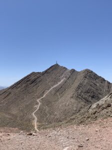
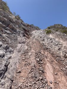
This was not exactly the “quick down and up” that we had been told it was. We were looking at probably the steepest and hardest part of the hike.
We put our packs back on, and headed down.
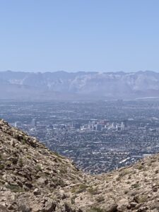
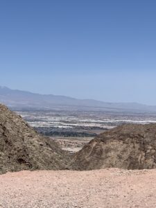
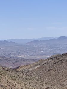
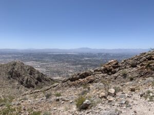
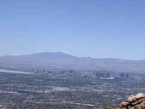
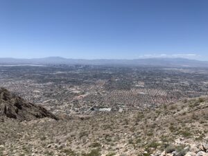
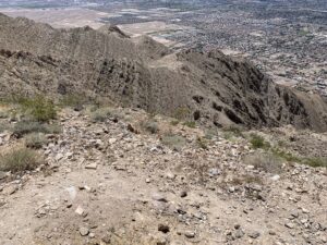
When we got to the bottom where it flattened out for a little bit, the valley opened up into a nice view of the city below. We took a few moments to look around, then we started our hike up towards the summit.
This section was pretty steep. The rocks were still slippery, and we were still stopping every 50 yards or so, just for a few moments.
The switchbacks in this section seemed a little rougher than the last ones we went through, but the beauty of all of it made it worth it.
When the switchbacks finally ended, the view opened up! In front of us was Las Vegas. To our left, the trail continued up to the summit. Just a short hike now and we would be at the top!
As we approached the summit, another couple was up there and they were calling to us to climb up to where they were. “The view is amazing from here – it drops right off though, so be careful” the one lady was calling down to us.
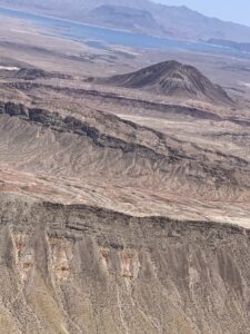
We climbed up and made our way to the very top of the summit. It was absolutely incredible. The views of Lake Mead and surrounding mountain ranges, was just breathtaking! Las Vegas was sprawled out like it was made of tiny little monopoly pieces.
I had read that there was a registry book at the summit. The couple that was there with us told us that the book was on the other side of the rocks from where we were at. I climbed down and went over to where she said it should be (they did not actually see the book themselves), and walked out onto the ridge as far as I dared go. I never saw a book.
The ridge carried out much further, and it is possible that the book was at the end of the trail, but the ridge looked narrow and I chose not to go. We had made it, book or no book.
After enjoying our view from the summit, and taking a short rest, it was time to head down. Not going to lie, the down hurt more than the up. It went a little quicker to go down, but the steepness and the rocks, made it really hard on the legs in spots.
We stopped on the saddle again, had our last energy bar, and looked ahead at the trail….uff da.
We didn’t stop any more until we got to the end of the trail. This was the part you could see from the road. When we reached the spot where we had talked to the first group of hikers, I looked at my watch. 5 1/2 hours. It had taken us the same amount of time.
We made it back to the truck, and just about collapsed into it. It felt so good to sit down. It also felt great knowing that we had made it to the summit (or summits, depending on who you talk to) of Frenchman Mountain! It was an absolutely incredible hike! Not at all what I had expected!
One Comment
Fitoru
This is a wonderful place go go hiking love the view, nice content, good read and informative.