Hiking HawkWatch Trail To Mt. Pisgah Peak
I had never heard of HawkWatch until recently when we were looking into interesting day hikes that we could take. I love to find things of interest in the areas that we travel to that aren’t necessarily the popular sites or well known to everyone. Sometimes the small, out of the way places have the best hidden gems! So, before I start talking about our actual hike, I want to talk a little bit about HawkWatch itself – what it is and where it is located.
HawkWatch International
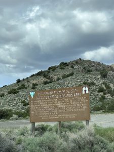
Founded in 1986, HawkWatch International is a non-profit organization that is based out of Salt Lake City, Utah. Their main purpose is to study the migration of raptors. Raptors have a migratory path that they follow every year as they fly to warmer climates for the winter. This path stretches all the way from Canada to southern Argentina! The path is over 8,000 miles long, and part of it just happens to pass through Nevada!
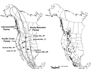
Every year between 10,000 and 25,000 birds visit the site which is located in the Goshute Mountains, just 30 miles south of West Wendover, Nevada. These birds consist of over 18 different species including hawks, eagles, vultures and falcons! It is at this site that wildlife biologists capture, survey, band and release the raptors in an effort to learn more about the raptors themselves as well as the impact our environment and landscapes have on them.
Anyone can hike up to the remote site at any time, but it is only during peak migration season that the biologists are up there. They welcome people of all ages to come up and watch, participate and learn. Visitors during the month of October are invited to help count, band and study these raptors – all while enjoying an amazing hike and the beautiful views from the almost 9000′ peak of Mt. Pisgah!
Lace up your hiking boots, grab some water, and come with us as we take you up the HawkWatch Trail to the peak of Mt. Pisgah!
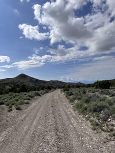
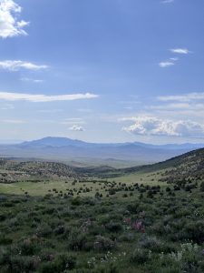
HawkWatch trail is located in the Goshute Mountains, about 30 miles south of West Wendover, Nevada. To get there, take Highway 93 for about 24 miles. Turn right at the Goshute Raptor Migration sign, and follow the signs with binoculars on it (about 5 miles of dirt roads).
The roads are in good condition and I would say pretty accessible by most vehicles.
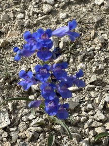
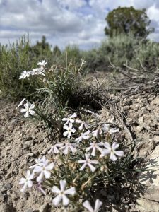
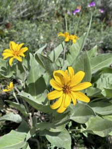
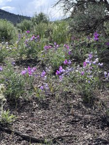
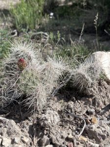
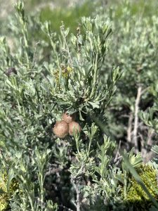
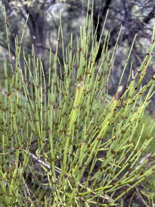
Along the drive, we stopped quite often so that I could jump out and get pictures. We didn’t visit during peak migration season, but we did visit while all of the wildflowers were in bloom, and there are a LOT! I will post all of the wildflower pictures that I took, as well as their description at the end of this post.
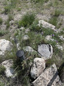
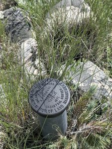
We also came across several survey markers.
We didn’t see much in the form of actual wildlife, but we did see plenty of tracks – and poop!
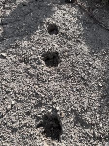
Along with all of the raptors that come through here, there are also plenty of mule deer, mountain lions and marmots. There are also wild horses, which we have seen, but not on our hike.
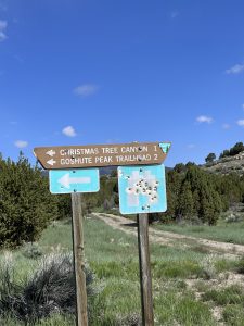
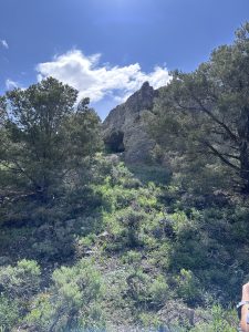
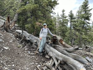
The trailhead parking is at the edge of Christmas Tree Canyon, likely named due to all of the pine trees that are found here – including the Bristlecone Pine!!
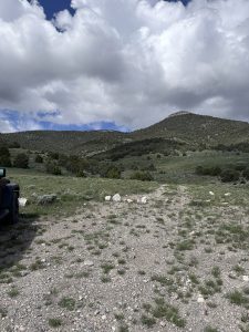
This is where the trail begins!
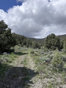
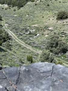
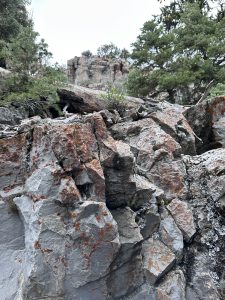
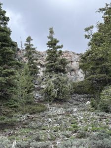
For about the first mile, the hike is pretty easy. Mostly flat, and the trail is very wide and visible. It winds its way past cliffs and through fields filled with more wildflowers!
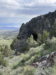
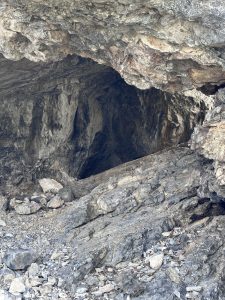
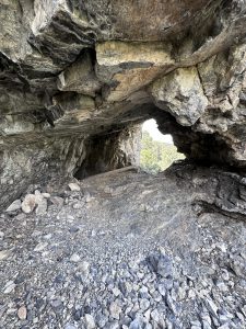
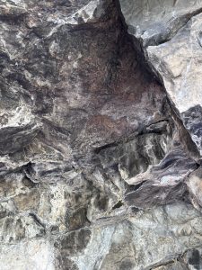
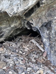
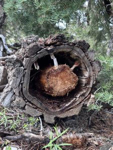
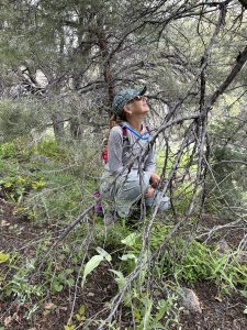
Shortly in to our hike, we came across a small cave in the side of a cliff. We climbed up to it, and looked around a little, before discovering there was an old nest in it. We left everything untouched, took a few photos, and continued on the trail.
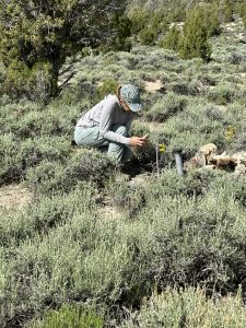
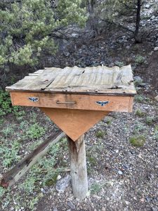
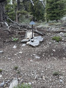
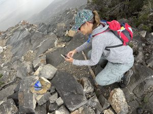
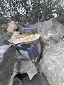
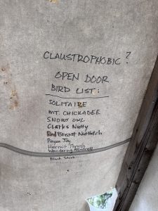
After about a mile in, we came to a marker for the Wildlife Viewing area.
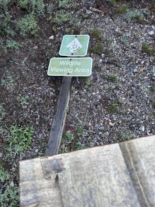
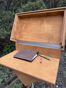
There is a box with a ledger in it that you can sign.
We chose to sign it on our way back down – we wanted to make sure we made it to the top first, and this is where the trail begins its (sometimes steep) climb upwards!
Along the way we found a really cool stick that we picked up to use as a walking stick! It is about to come in handy!
We came across so many trees and plants and wildlife poop, and every turn on the path brought a different view and different things to look at!
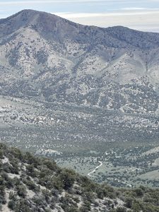
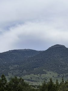
For part of the hike, I had my eye on another peak, thinking that was where we were headed.
It looked really high up. I would find out later, that the peak we were actually headed to, was hidden from that, and actually higher! Its amazing to me how distorted distances and heights can appear depending on where you are.
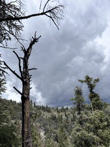
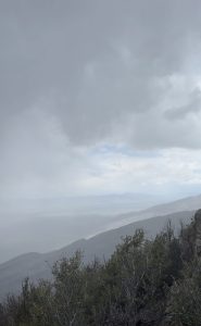
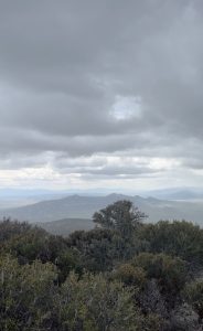
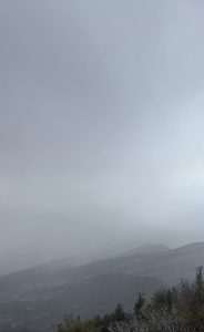
As our view and location changed, so did the weather! We watched several times throughout our hike, as the skies turned from sunny and blue, to dark and threatening. Most of the time the storms passed us by, but we did get caught in the rain more than once. Luckily, it never lasted long, and as soon as the sun came back out, it warmed up and we dried off quickly.
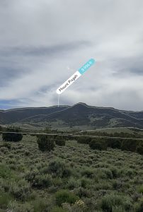
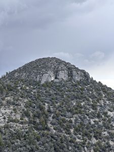
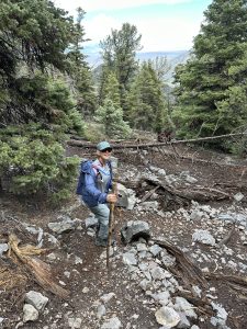
After about two and half hours of hiking up, we came across the raptor study site where the biologists set up camp.
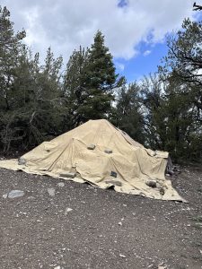
This camp sits directly at the base of the Mt. Pisgah summit.
Everything in camp was covered with tarps and canvas to keep it safe, and we didn’t disturb any of it.
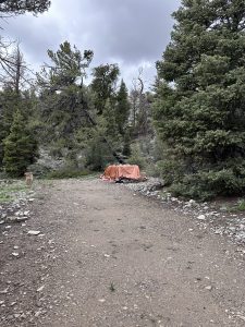
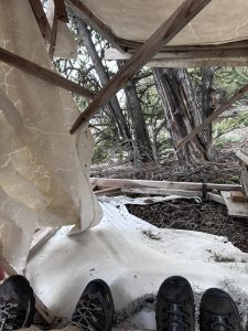
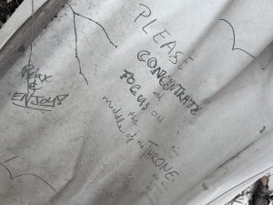
We continued on up the trail that would lead to the summit, and on the way we came across what I thought at first were bear-proof garbage receptacles.
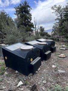
Upon a closer look, we realized that it was actually the “restroom” for camp.
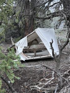
There was a canvas tent, which we are assuming is used as a privacy shelter over the commodes, that had been blown over by the weather. This would come in handy shortly!
Just beyond this site was the trail leading up to the summit. Difficult to see at times, we followed it up and around, over a few rocky areas, right to the summit!
We were now standing at 8996′ feet!
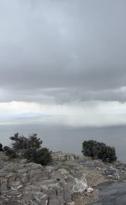
The temperature was a good 40 degrees lower than at the base of the trail where we parked the Jeep! As we stood at the summit, in awe of how amazing the view was, a thunderstorm was fast approaching! We could see the approaching massive wall of rain that was about to be right on top of us!
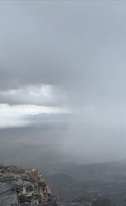
We hurried to sign the log book, and remembered that tent that had been blown over. It was about to become our shelter out of the storm.
We scurried down from the summit, and made it to the tent just in time! It wasn’t until we had climbed into (or under, I suppose) the tent, that we saw all of the messages. We sat there waiting the storm out, eating some lunch (yes, we ate in the “bathroom”) and reading what people had written on the “bathroom walls”.
Once the storm passed and the skies cleared, we were back out and headed down the trail.
As we hiked our way back down (following the exact same route we took up), we noticed things that we didn’t notice heading in the other direction.
One thing that caught my eye, was a few old cans scattered around. My first thought was “I hate that people just throw their trash anywhere!” As we stopped to look at them though, we noticed that the tops were not the “pull tab” tops that are on cans today. We wandered in a little closer. These cans were really rusted, partially buried, and had a couple of bottles with them as well. We started uncovering them to see the labels. All of the cans had the “church key” style opening on them, and the labels were still visible through the rust.
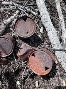
There were a mixture of beer cans and soda pop cans.
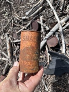
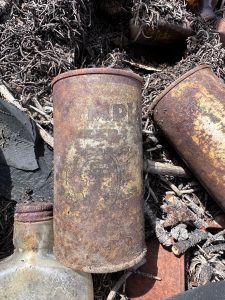
All of them dated back to anywhere between the 1930’s and the 1960’s. These cans had likely been here anywhere from 60-85 years! (Still garbage, but cool garbage!)
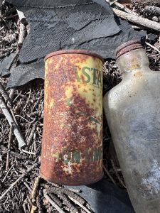
The bottle of Crown also dates back to 1935-1964.
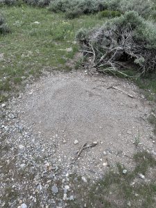
We also noticed there were some enormous ant hills along the trail!
We stopped at the box to sign the viewing area log on our way out.
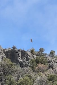
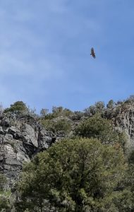
As we came back to the beginning of the trail, up above by the cliffs, a hawk circled around. It would be the only raptor we saw on our hike, but we stood and watched for quite a while. It gave us a brief glimpse into how amazing this hike must be during the actual migration season!
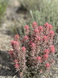
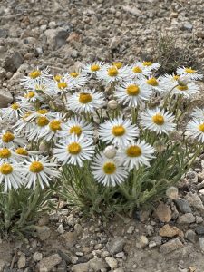
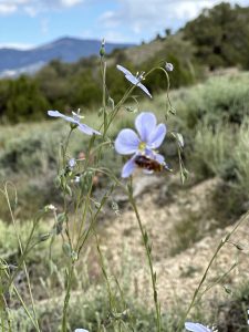
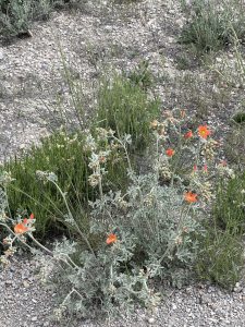
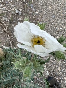
The Wildflowers of HawkWatch
Below are some of the wildflowers we saw on our hike. Scroll through for some fun facts about each one!
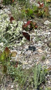
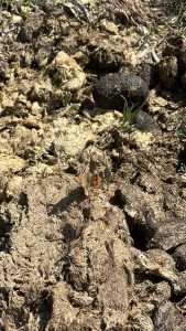
Butterflies of HawkWatch
We saw a couple of butterflies while we hiked as well…
2 Comments
Char
Looks like an awesome hike, and lots of great info in this post!
Kathy
It was a fantastic hike and we would totally do it again during the migration season!