Hiking Chimney Rock
Our latest adventure is taking us just north of San Francisco. Follow Sir Frances Drake Boulevard as it winds its way through the Point Reyes National Seashore area, and at the very end, on the eastern most tip, you will come to an area called Chimney Rock. It is here that we decided to hike around a little bit and see what we could find.
The Drive
The destination is only a part of any adventure. Another part, sometimes overlooked, is the drive getting there. As our travels have taken us along to so many different areas, I have learned to take notice of the drive. So much passes us by as we are driving along. We take time now to look around, stop if something really catches our eye, and, if it really peaks our interest, we look it up later to see what we can find on it.
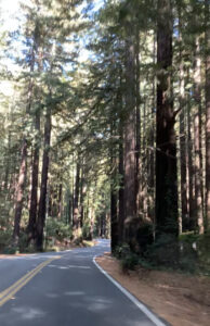
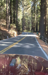
The drive out to Chimney Rock was worth it all on its own. It was a two hour drive that took us through some beautiful areas. Both the Pt. Reyes- Petaluma Rd. and the Sir Frances Drake Boulevard wind their way through farms, past rivers and reservoirs and along the foothills of mountains and rocky cliffs along the coast. The turns are tight, and the speed limit is faster than it probably should be (especially since bikes are allowed on the road), but we just slowed it down a notch, and enjoyed the ride!
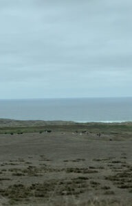
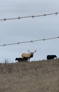
Sir Francis Drake Boulevard is a 43 mile stretch of road that runs from the Point Reyes Peninsula to the San Rafael Bridge. This stretch of road offered beautiful scenery as well as some historical locations. This is where the Historic Point Reyes Ranch District is located. No wonder I loved this drive so much…two of my favorite things, together, all along this one stretch of road…..cows and ocean! Who knew they went together? I always used to say “the perfect place for a home would be an area that has the ocean out my front door, and cows out my back door.”. Well, here they were – cows at the ocean! These have got to be some happy cows!
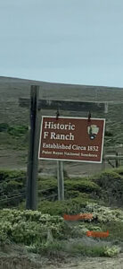
The Historic Ranch District takes up about 22,000 acres along the coast in the Point Reyes National Seashore area. They are still working ranches, known as the “Alphabet Ranches”, many of which are run by the actual descendants of the early Point Reyes Dairies (1857-1939).
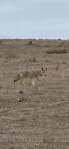
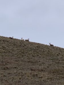
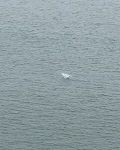
Another exciting part of this drive was the wildlife! Drive along the coast, and you expect to see seagulls and pelicans, but what I did not expect to see was elk, deer and coyotes! There they were though, living their best beach life!
Chimney Rock
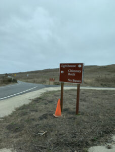
As you approach the tip of the peninsula, you can go east or west. West, will bring you to the Pt. Reyes Lighthouse. The Lighthouse is still closed (I am assuming due to the pandemic), so we decided to save that for another day. To the east is Chimney Rock. This is where we spent our day.
We drove down the road as it winded its way along the steep cliffs.
At the end of the road, there is a small parking area, along with a couple of park bathrooms.
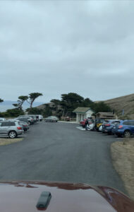
Trails go off in several directions from here.

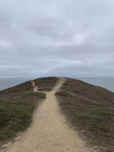
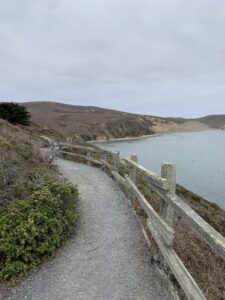
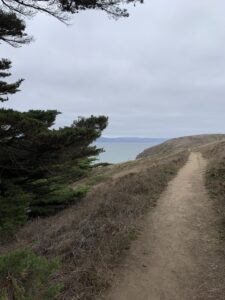
We chose the Chimney Rock Trail to start. This isn’t an overly long hike – just around 3 miles. The views that it offers though, make it a hike worth taking!
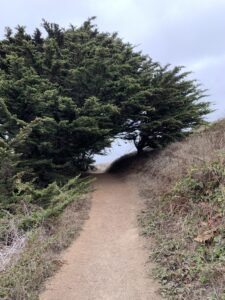
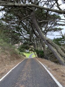
The trail starts at the parking lot, and takes you through a section that is green and grassy, where the trees almost form a tunnel over the trail.
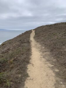
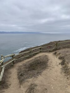
The entire trail is gravel, and in some spots, it has begun to erode away. Watch your step in these areas, as it is easy to lose your footing.
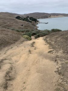
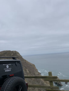
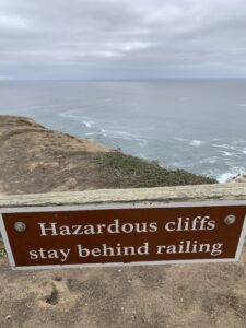
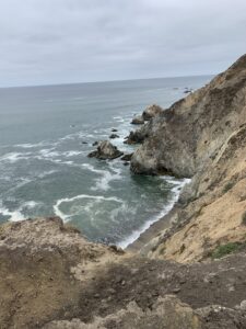
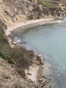
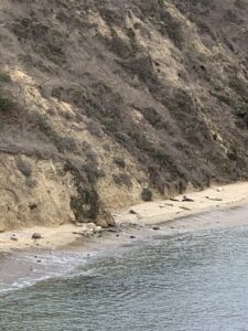
As you come out of the grassy area, the trail begins to climb up, as it curves around the cliffs. We approached the edge with caution, as we looked out over the ocean. The waves were crashing into the rocks below us, and all along the beach, sea lions were lined up in the sand, just escaping the incoming waves.

We watched as two younger sea lions played with each other.
As we continued on the trail, we noticed little off shoots of smaller trails. These were all clearly posted as “unauthorized trails”. These smaller trails led the way out to the edge of the cliffs, many of which are very unstable. While they do look like they would offer some incredible views, I read where they are actually fining people if you are caught on them. The risk of injury to oneself, as well as any rescuers, is too great. We made sure to stay on the designated trail.

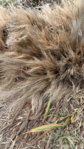
Along the way, we were seeing tufts of grass in the trail. These tufts resembled, what looked like brown horse hair sticking out of the ground. Interested to know what it was, I took a picture of it to look up later when we had good cell service. Turns out, it is called Wavy Leaf Soap Plant. It is an herb that was used by the Native Americans. They would crush the bulbs and turn it into a soap that they could then use to clean clothing.
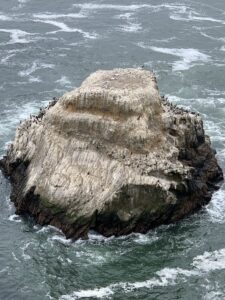
We continued on the trail until it came to the edge of the cliffs, where it made a final loop around, before heading back. This is where Chimney Rock is actually located. Down below the edge of the cliff, just off shore, sits a large sea stack known as Chimney Rock. I’m guessing it got it’s name from the fact that it looks like a giant chimney rising up out of the ocean. If you come here during the winter months, you will most likely see Gray whales out here as well!
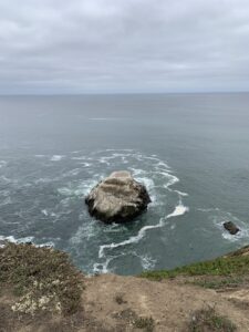
The San Andreas Fault runs right through the Pt. Reyes Peninsula. Due to the Fault Line, and the Great San Francisco Earthquake of 1906, many natural formations can be found here along the California coastline. The location of Chimney Rock, helps to protect Pt. Reyes from damaging winds and waves coming off of the ocean. All of the beaches below the cliffs at Chimney Rock, are inaccessible.
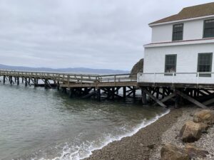
Pt. Reyes Lifeboat Station
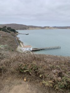
When we finished checking out the cliffs and Chimney Rock, we hopped back on the trail and took it down towards Drakes Bay, to see the Historic Pt. Reyes Lifeboat Station. From the trail, you can see the white building with a red roof, sitting right on the shore of Drakes Bay.
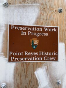
The Lifeboat Station is currently closed, while they do some preservation work to it, but we were still able to hike down to it, and get a good look around.
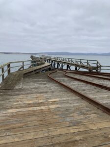
The Lifeboat Station was built in 1889, and originally sat on the shore of the Pacific Ocean, to render aid to ships that were stranded, or wrecked, at sea. The ocean shores were unprotected, and, as a result, so was the Lifestation. In 1927, the station was moved to the more protected shores of Drakes Bay, where it sits today.
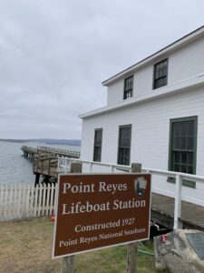
For 37 years, the Lifeboat Station assisted in shipwrecks (14 of which were major), before the property was transferred to the US Navy in 1927. The Coast Guard built a marine railway onto the station, for launching motorized lifeboats. They also added dorm style living spaces for the crew members.
During the first ten years that the Navy had possession of the station, it assisted over 45 ships, three of which were major shipwrecks. However, as maritime technology improved, the need for the Lifestation began to diminish. By 1956, the lifesaving boat they were using, had been put out of service. Eventually, a new Lifeboat Station was built in Bodega Bay. This was a more ideal location and would provide the space to house the new, larger lifeboat. The Pt. Reyes Lifeboat Station was decommissioned in 1968, and possession was transferred to the Pt. Reyes National Seashore.
Finishing up our hike
After walking around the Lifeboat Station, peering in the windows, climbing up the stairs and reading all of the signs, we headed back up the blacktop road that brought us down to it. The trail picked up again at the top of the hill, bringing us back through some green, grassy areas, and more trees that draped down over the trail, creating another tunnel of sorts.
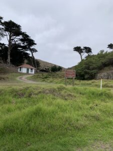
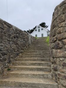
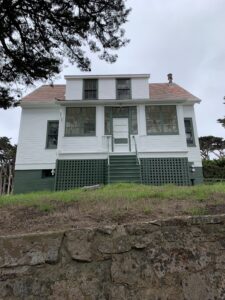
The trail brought us to a couple of buildings. These are the Park Residence buildings, and were not open to the public. The large house, with its stone stairway leading up to it, appeared to be empty, but we stayed clear of it nonetheless.
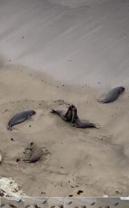
As the trail wrapped around the edge of the bay below, we came to the Elephant Seal Overlook Trail.

This trail brought us around to a little cove in the bay. From the overlook bridge, we could see all of the elephant seals down below on the beach. We stood watching and listening to them, as they let out loud, trumpeting grunts.
The Elephant seals here had disappeared at one time, remaining gone for almost 150 years. In the early 1970’s, they returned and have been here ever since. Mating season, winter into spring, is the best time to see the largest amount of seals, but you will see them on any given day.
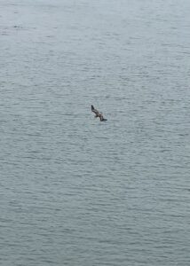
We watched the seals from the overlook for quite awhile, as pelicans up above, fished from the sky, and would divebomb the water for their catch!
From here, we made our way back to the parking area, took a few minutes to eat some lunch that we packed with us, and then started the drive back home.
As far as hikes go, some people may find this one to be a little anti-climatic. While the hike itself is neither long or difficult, the scenery alone made it worth it to me. The natural history, the maritime history and all of the wildlife and sea life that make up Chimney Rock are totally worth spending a day here, walking around. If you enjoy being outdoors, the Chimney Rock hike will not disappoint you! Definitely another reason for me to love the San Francisco area and coast of California!
Until next time, happy hiking!